Day Fourteen - Reno to Fremont
 |
| Finally, a day trip under 7 hours duration. And some lovely scenery. |
So we headed up the street in the direction back to Route 80, when we saw this sign:
 |
| A very pleasant place to eat in Historic Truckee. |
We had two waitresses, and one of them asked us about our origin and destination. She suggested we ignore Interstate 80 for a while, and instead opt for Historic Route 40, which would get us back on our course eventually, but without wasting the opportunity for some genuine sightseeing. All we can say to the pleasant person with the Peace earrings is, Thank You, Thank You, Thank You.
 |
| Donner Lake, near the beginning of Historic Route 40. |
The Donner Pass
The byway she suggested is known in American history as the Donner Pass. For the next fifteen miles or so we saw some of the most spectacular scenery, and felt some of the most empathy for our pioneer forebears, as one can imagine.
 |
| The horizontal line across the steep mountainside above Donner Lake is the railroad. Think of the courage of thosewho built it, and drive their engines across it. |
 |
| Donner Lake, from halfway up the pass that made history. |
 |
| And three-quarters. |
 |
| The point on the drive where we reach the level of the railroad. |
 |
| This plaque tells the story of several families who set out together from Council Bluffs, Iowa (where we were one week ago) to reach California. All of them succeeded, despite fifteen out of seventeen of the men riding ahead for help, then enlisting in the Mexican War, leaving just two of the men to bring all the women and children across the pass in dead of winter. No plaque mentions the Donner Party itself; no doubt explaining the issue of cannibalism on a National Park plaque presents problems. |
 |
| A look back at the winding trail that got us here, and Donner Lake in the distance. |
 |
| The vista point near the summit of Donner Pass, slightly higher than the railroad. |
 |
| This plaque about the Donner Summit Bridge is actually well below the summit. |
What's the most common bush in California? No doubt it's Oleander:
 |
| Oleander lines pretty much every major highway in California. |
 |
| We could just duct tape a camera to the dash and set it to snap every ten seconds. Eight out of ten shots would feature oleander. |
 |
| There are much better examples of the phenomenon than this, but our camera, and our camera skills, left us with this one example. |
 |
| The golden hills of California, a ridge of yellow grass that runs the length of the east side of San Francisco Bay. We aren't certain the yellow is normal or simply due to the lack of rainfall. |
 |
| Palm Trees! Picture taken from the window of a very fine Mexican Restaurant, whose name is different from the one our GPS listed, and which I can't remember, but which served great genuine cuisine and extraordinary margaritas. |
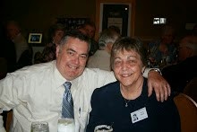
 |
| Mary Frances, with good food and excellent drink. |
.
No comments:
Post a Comment